GIS Services – Smart Mapping & Data Solutions
GIS Services by Orion Cadd Solutions help businesses and industries manage, analyze, and visualize geographical data with accuracy and efficiency. Our professional Geographic Information System services support better planning, improved decision-making, and streamlined operations.
By using advanced GIS mapping solutions, spatial data analysis, and geospatial technologies, we transform raw location-based information into meaningful digital maps and reports. As a result, organizations gain better control over their assets, land records, infrastructure, and environmental data.
Whether you need digital mapping services, parcel mapping, or raster-to-vector conversion, our GIS experts are here to support your project from start to finish.
Introduction to Our Professional GIS Services
GIS Services play a crucial role in managing geographical and spatial data across industries such as construction, urban planning, utilities, transportation, and real estate.
At Orion Cadd Solutions, we provide end-to-end Geographic Information System services that include data capture, processing, analysis, and visualization. Moreover, our solutions are designed to be user-friendly, reliable, and scalable.
By combining modern tools with skilled professionals, we ensure high-quality geospatial services that meet industry standards.
What Are GIS Services?
GIS Services by Orion Cadd Solutions help organizations collect, manage, analyze, and display geographic data digitally. These services convert maps, images, and land records into interactive systems that improve planning, monitoring, and decision-making.
Our GIS Services include:
- Raster to Vector Data Conversion
- Parcel Mapping
- Orthophoto Digitization
- Topographic Mapping
- Spatial Data Analysis
Our Comprehensive GIS Data Services
We offer a complete range of GIS mapping and data management solutions to meet diverse project requirements.
GIS Data Conversion (Raster to Vector Conversion)
We convert scanned maps, satellite images, and paper drawings into accurate digital vector formats. This makes data easier to edit, analyze, and integrate with other systems.
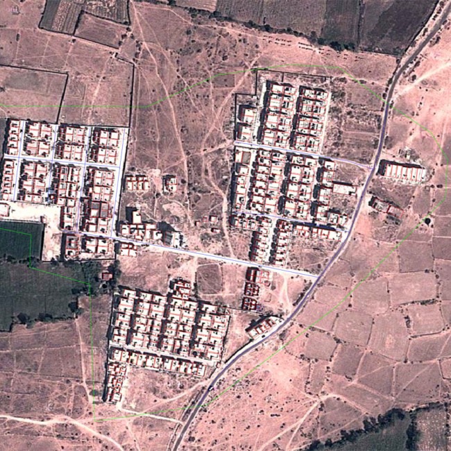
Parcel Mapping
Our parcel mapping services help manage land ownership, property boundaries, and cadastral records. These maps are useful for government bodies, developers, and real estate companies.
Orthophoto Digitization
We process aerial and satellite images into high-precision orthophotos. This ensures accurate measurements and improved spatial clarity.
Topographic Mapping
Our topographic maps represent terrain features, elevations, roads, and water bodies. These maps are essential for engineering, infrastructure, and environmental projects.
Why Choose Orion Cadd Solutions for GIS Services?
Choosing the right GIS partner is important for project success. Here’s why clients trust us:
- Experienced GIS professionals
- High-accuracy data processing
- Advanced software and tools
- Customized project solutions
- On-time delivery
- Affordable pricing
In addition, we focus on clear communication and continuous support throughout your project lifecycle.
Benefits of Using Our GIS Mapping Solutions
Our GIS Services offer several advantages:
- Improved data accuracy
- Better asset management
- Faster decision-making
- Enhanced planning capabilities
- Reduced operational risks
- Easy integration with CAD and CAFM systems
As a result, organizations gain long-term value and operational efficiency.
Commonly Asked by Users – FAQ
What industries use GIS Services?
GIS Services are used in construction, utilities, real estate, government planning, transportation, agriculture, and environmental management.
How do GIS Services improve business operations?
GIS Services help visualize data, monitor assets, analyze risks, and support strategic planning using location-based insights.
Can Orion Cadd Solutions customize GIS projects?
Yes. We provide customized Geographic Information System solutions based on client needs, project size, and technical requirements.
Get Started with Our GIS Services Today
At Orion Cadd Solutions, we are committed to delivering reliable, scalable, and accurate GIS Services that support your business growth. Whether you need parcel mapping, spatial analysis, or complete geospatial data management, our team is ready to help. Contact us today to discuss your project and discover how our GIS solutions can add value to your organization.